Integrating Blue Carbon Estimation into Mangrove-Based Coastal Protection Infrastructure Planning: A Case Study in Dompak Island, Tanjungpinang
Keywords:
Blue Carbon, Mangroves, Google Earth Engine, Coastal Protection, Natural InfrastructureAbstract
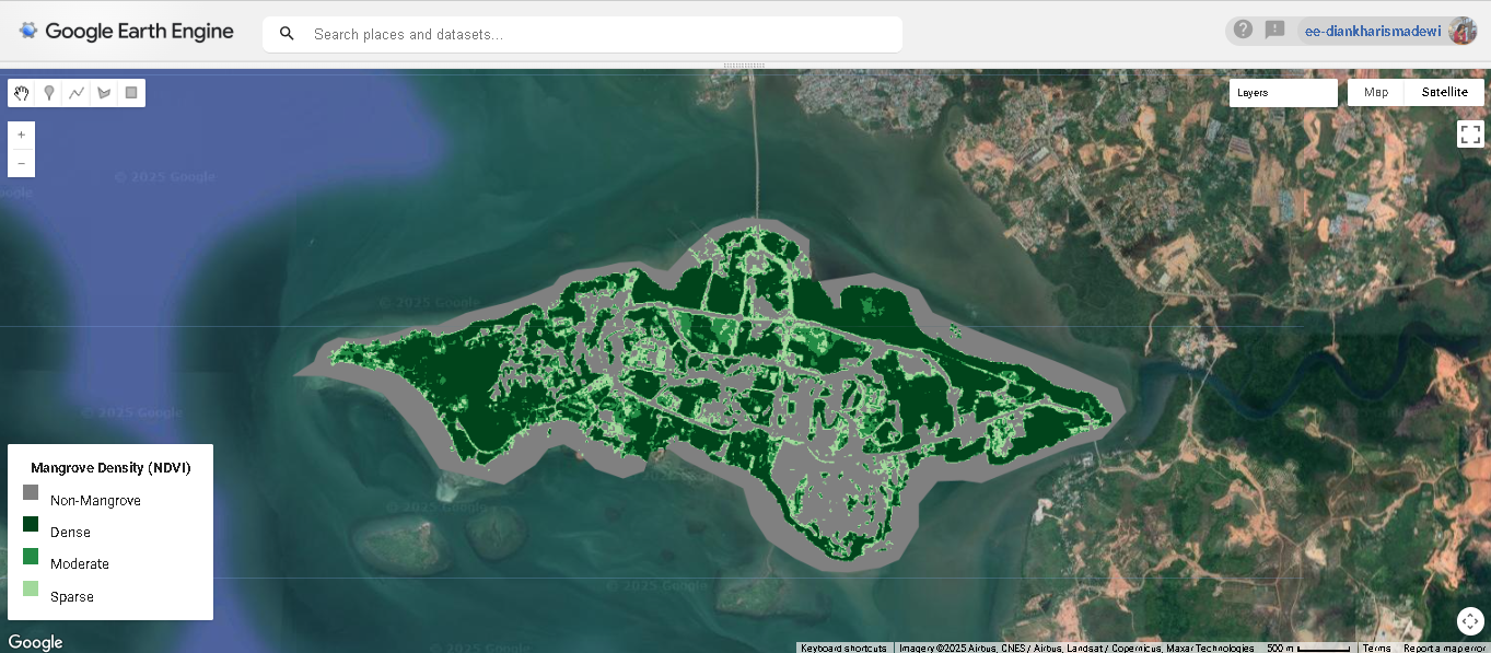
Ecosystem-based coastal protection offers a strategic approach to mitigating the impacts of climate change, particularly in small island contexts. This study integrates remote sensing and geospatial analysis to estimate blue carbon stocks in the mangrove ecosystems of Dompak Island, Tanjungpinang, using Google Earth Engine (GEE) and Sentinel-2 satellite imagery. Through the application of the Normalized Difference Vegetation Index (NDVI) and an empirical model for Above Ground Biomass (AGB), spatial carbon stock distributions were generated and classified into three functional zones: conservation, restoration, and critical protection. Results reveal that areas with moderate vegetation exhibit the highest carbon stock (32.00 tons/ha), suggesting ongoing biomass accumulation. This spatial analysis informs a zoning framework that supports ecosystem-based infrastructure planning. The integration of carbon mapping with adaptive civil engineering strategies demonstrates a scalable model for climate-resilient coastal development in vulnerable regions.